Non-intrusive magnetometer surveys are one of the most effective, safe and efficient means of detecting shallow-buried UXO on areas of relatively ‘clean’ greenfield land.
Depending on factors such as the size of the site, topography, ease of access, nature of the identified risk and likely depth of targets, 1st Line Defence can deploy a range of Non-intrusive UXO Survey techniques from manual ‘walkover’ and vehicle-towed to Drone / UAV survey.
This autumn, 1st Line Defence invested in the latest commercially available UAV technology and combined it with a specially designed magnetometer system from one of the world’s leading providers of magnetic and electromagnetic survey systems and components.
- Fast to deploy
- Cover large areas with Quick set-up time
- Cost effective way of checking feasibility of a non-intrusive magnetometer survey
- Ideal for survey of particularly clean and undisturbed greenfield sites
Specifically designed to be mounted on a UAV, the system consists of an ultra-lightweight carbon fibre sensor tube with two built-in 3-axis fluxgates, data logger and integrated D-RTK GPS with local base station.
The advanced sensor can distinguish between motor noise, net frequencies, temporary interferences and ground signal, and with a 200Hz sampling rate, means it can be deployed directly beneath the drone without effecting the efficacy of the equipment.
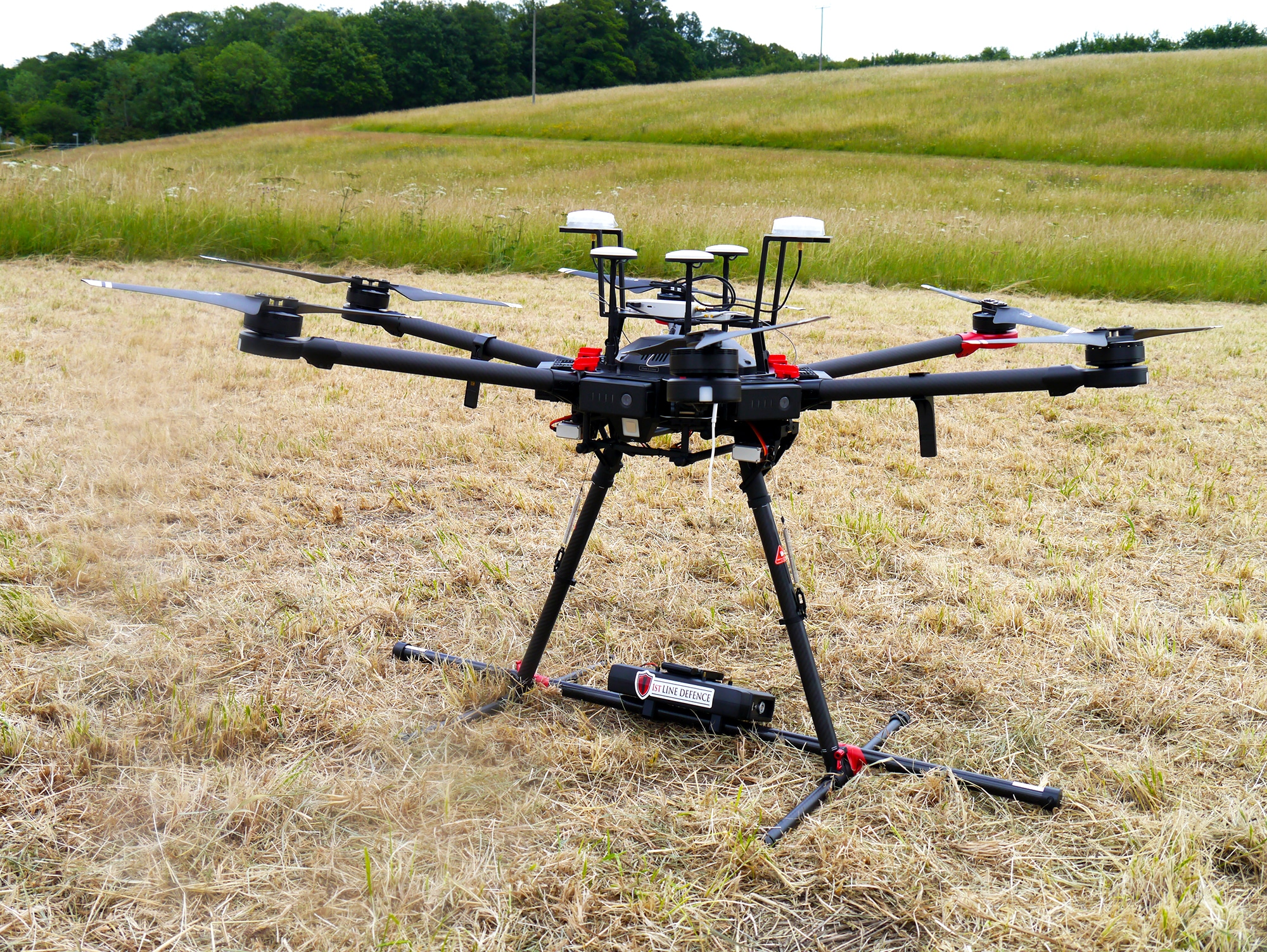
Close-up image of 1st Line Defence’s new Drone / Aerial UXO Survey System. Image source: 1st Line Defence.
Our drone pilots carry the PfCO qualification (Permission for Commercial Operation) and our drone has undergone the commercial application approval under the Civil Aviation Authority (CAA).
With current magnetometer systems, the very best results are achieved by deploying the sensor as close to the ground as possible. Our manual/towed systems therefore provide the highest resolution data and are able to maximise the depths to which detection of discreet anomalies is possible.
This is particularly useful when trying to detect very small items of UXO or larger items which are deeper buried. The height that a UAV has to fly at does effect the sensitivity of the system, which should be borne in mind when determining which system to utilise for a particular project.
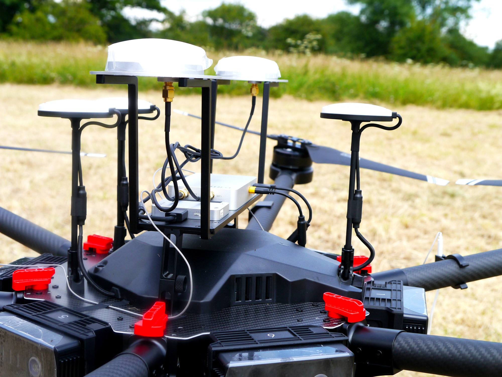
Close-up image of the sensors used on 1st Line Defence’s new Drone / Aerial UXO Survey System. Image source: 1st Line Defence.
There are however various tangible benefits to utilising an aerial survey system:
- Areas which are difficult or not possible to survey on foot/by vehicle
- Marshy/partially flooded areas/Areas with access restrictions
- Deploy as a Phase One survey of large open areas to determine level and locations of significant ferrous contamination
- Used to determine suitability of ground-based non-intrusive magnetometer survey


 Audited")


